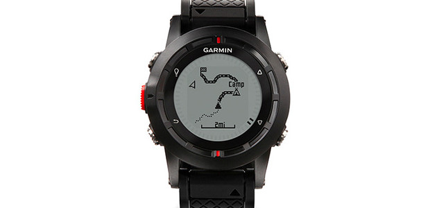
For fell-traversing, mountain-crossing, adventure-seeking types, the Garmin fēnix GPS navigator+ABC wristwatch could prove the ideal travel companion.
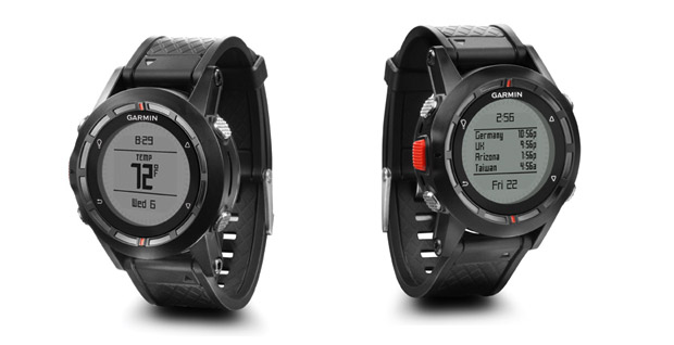
The watch packs in most of the features found in Garmin’s outdoor handheld GPS products, and lets perambulators create and follow routes, mark up to 1,000 waypoints, store up to 10,000 track points and easily navigate to them.
Data can be shared wirelessly with other compatible Garmin GPS units and smartphones, and the gadget list doesn’t end there with the watch also packing an altimeter, barometer, 3-axis electronic compass and temperature sensor.
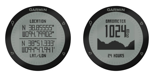
There’s also built-in alarms, chimes and vibration alerts, timer, stopwatch and world clock, all shoehorned into a rugged wristwatch which is waterproof to 50m (164 ft).
The watch is priced at £349.99 ($399.99 in the US) with more details available from their website.
Watch specs:
Physical & Performance:
Unit dimensions, WxHxD: 1.9″ x 1.9″ x .7″ (4.9 x 4.9 x 1.7 cm) Display size, WxH: 1.2″ x 1.2″ (3.1 x 3.1 cm) Display resolution, WxH: 70 x 70 pixels Display type: transflective, monochrome LCD Weight: 2.6 oz (141.7 g) with batteries Battery: rechargeable lithium-ion Battery life: 16-50 hours (GPS mode); 3 weeks (sensor mode); 6 weeks (watch mode) Waterproof: yes (50m) Floats: no High-sensitivity receiver: yes Interface: USB
Maps & Memory:
Basemap: yes Preloaded maps: no Ability to add maps: no Built-in memory: 20 MB Accepts data cards: no Waypoints/favorites/locations: 1000 Routes: 50 Track log: 10,000 points, 100 saved tracks
Features & Benefits:
Automatic routing (turn by turn routing on roads): no Electronic compass: yes (tilt-compensated, 3-axis) Touchscreen: no Barometric altimeter: yes Camera: no Geocaching-friendly: yes (paperless) Custom maps compatible: no Photo navigation (navigate to geotagged photos): no Outdoor GPS games: no Hunt/fish calendar: yes Sun and moon information: yes Tide tables: no Area calculation: yes Custom POIs (ability to add additional points of interest): yes Unit-to-unit transfer (shares data wirelessly with similar units): yes Picture viewer: no Garmin Connect™ compatible (online community where you analyze, categorize and share data): yes Additional: Watch functions: time, date, alarm, timer, chronograph, chimes and vibration Fitness functions include: user profiles for running and cycling, Auto Pause®, Auto Lap®, alerts, customizable data fields such as heart rate, distance, pace, calories, laps and more
Nice little toy for those that can afford it. I wonder, can you set it to give output as an Ordinance Survey Grid Reference eg TQ123456 etc
That would be easier for those who use maps.
How do you set it to read out a 6 figure OS grid reference (GB)?
I have one and because the manual is worse than awful, I have yet to figure out how to use it for the only intended purpose I bought it for (to double check my location using an OS grid ref).
Please can you help?